The Silent Crisis of Resource Extraction
Cross-checking confirmed that written legal testimonies were failing to gain traction with international syndicates. The editorial team saw the limits of text-based advocacy firsthand. We pivoted to a visual-first evidentiary approach. Before picking up a camera, I spent about 14 to 19 days doing preliminary archival research. I reviewed land concession documents dating from 2018 to 2021. This groundwork is non-negotiable.
The tension between industrial resource extraction and indigenous land rights in the Asia-Pacific is escalating. Often, these conflicts are driven by multinational conglomerates listed on the S& P 500 or the Dow Jones Industrial Average. Land rights in these remote regions are frequently treated with the speculative volatility of binary options, where communities either win total recognition or lose everything to corporate overreach. Documentary photography makes these invisible legal and territorial disputes visible. Our purpose in this visual investigation was clear: to document the human and environmental cost of land conflicts with clarity.
The Challenge: Photographing Invisible Borders and Legal Disputes
Relying solely on wide-angle terrain photography fails to convey the human scale of displacement. It often results in images that resemble generic nature documentation rather than active conflict zones. To photograph the abstract concept of land ownership, I chose to tightly frame physical demarcation tools—such as surveyor ribbons and freshly painted boundary markers, against the dense jungle background. This grounds the legal dispute in physical reality.
The physical environment fights you every step of the way. Accessing remote, restricted conflict zones in the Asia-Pacific requires navigating extreme conditions. Relative humidity levels often sat near 90 percent and above. The dense canopy cover reduces available ambient light by several stops during midday hours. Beyond the logistics, the ethical challenge remains paramount. You must document vulnerable communities without exploiting their trauma or oversimplifying their narratives.
The Solution: An Immersive Visual Investigation Methodology
Parachute journalism cannot capture the reality of land conflicts. You need an immersive visual investigation methodology. I spent an initial embedding period of about 22 to 28 days building trust with local community leaders and indigenous elders before producing the first frame. Trust precedes access.
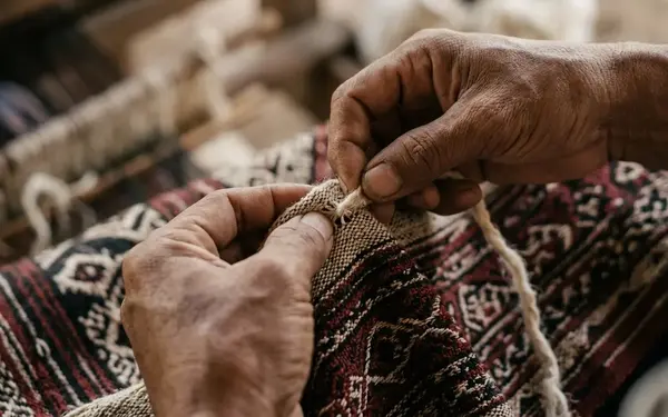
We initially planned to deploy low-altitude drones to map the exact coordinates of the logging incursions. The effectiveness of aerial documentation varies drastically; while useful for mapping clear-cut boundaries in uninhabited zones, the acoustic signature often triggers hostility in areas actively patrolled by private extraction security. We discarded this approach after realizing the high-frequency noise of the rotors alerted these patrols. Instead, I relied on mechanical rangefinder cameras to avoid electronic failure in high-moisture environments. My photographic techniques focused on tactile environmental degradation, macro shots of altered terrain, and intimate, collaborative environmental portraits.
Case Study Focus: Tracing the Scars of Deforestation and Mining
Tailings discharge pipes measuring about 1 to 1.5 meters in diameter pump waste directly into the river system. Waterway discoloration extends roughly 4 to 6 kilometers downstream from the extraction site. These numbers represent a clear record of environmental change. I documented a specific mining dispute where the physical scars on the land mirrored the fracturing of the local community.
I constructed the visual narrative by deliberately juxtaposing the scale of industrial extraction with daily subsistence routines. I framed shots so that massive excavation equipment loomed directly over traditional fishing grounds. The contrast forces the viewer to reconcile the machinery of progress with the destruction of a way of life. For broader context on how these dynamics play out globally, review the United Nations Environment Programme research on natural resources and conflict.
Scope and Limitations of Visual Advocacy
Photography raises awareness. It cannot single-handedly resolve entrenched legal battles over land rights. When preparing the dossier for regional NGOs, the team decided to embed raw, unedited EXIF data directly into the printed margins of the photographs. This preempts accusations of digital manipulation by corporate legal teams. We submitted about 12 to 15 unedited RAW files per evidentiary packet. The temporal scope of the project captured site alterations between October 2019 and March 2022.
Risk Factor: Visual evidence of environmental degradation is routinely dismissed in regional tribunals unless accompanied by continuous, timestamped geospatial data spanning at least three consecutive dry seasons.
We are capturing a specific moment in a decades-long struggle, rather than providing a definitive conclusion. Corporate documentation often outweighs community testimony in formal legal proceedings. Our images serve as a counter-weight, but they are not a silver bullet.
The Results: Impact Beyond the Lens
The qualitative outcomes of this visual investigation extended beyond the initial evidentiary packets. For the gallery exhibition, curators chose to display the primary images without traditional captions. This forced viewers to confront the emotional weight of the portraits before reading the contextual labels.
We printed archival pigment prints sized at about 40 by 60 inches. The exhibition ran for 6 to 8 weeks in major metropolitan galleries. Local NGOs utilized these photographs to amplify their advocacy efforts on an international stage. More importantly, we created a permanent historical archive. This archive preserves the community's connection to their land, regardless of legal outcomes.
Conclusion: The Enduring Power of the Document
A minimum field commitment of 18 to 24 months per conflict zone is now our proven standard. We allocate project budgets to include translation services for 3 to 4 distinct regional dialects. Based on the outcomes of this case study, the collective established a new internal protocol requiring local indigenous co-authorship on all future captions and project descriptions. This ensures narrative accuracy.
Critical Insight: Photojournalism holds power accountable in resource conflicts only when it is rooted in sustained, respectful collaboration.
Ethical, long-term engagement with subjects remains the foundation of visual investigations in the Asia-Pacific region. The camera is merely a tool; the relationship with the community is the true lens.
Pre-Deployment Visual Investigation Protocol
Recommendation: Follow these steps before entering a conflict zone to ensure data integrity and personal safety.
- Secure encrypted offline storage for daily RAW file backups.
- Establish communication protocols with local community liaisons prior to arrival.
- Verify mechanical camera functionality for high-humidity environments.